
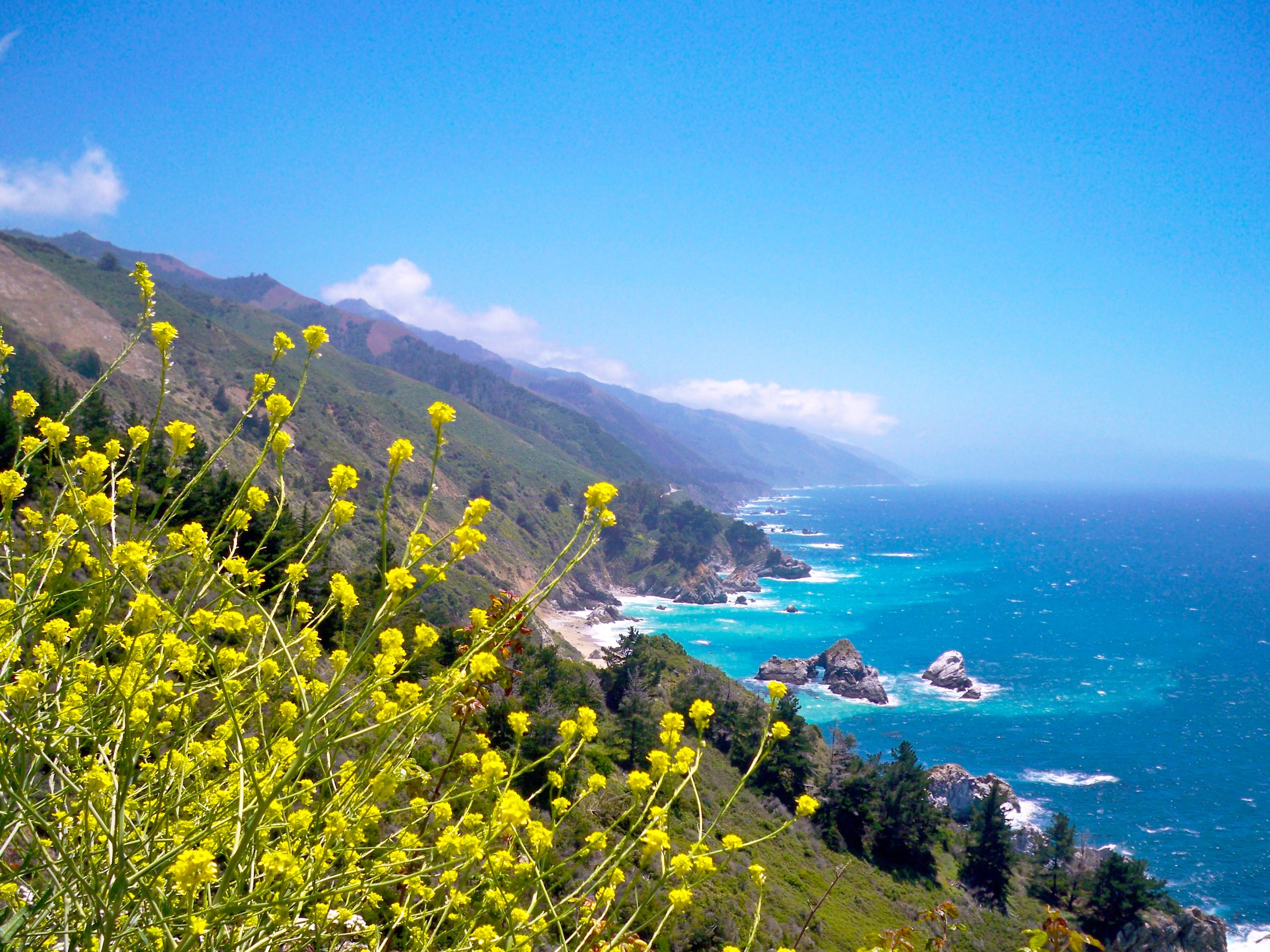
Driving the Pacific Coast Highway from San Francisco to Los Angeles is one of those trips that actually lives up to the hype. You get redwood-lined switchbacks, a bridge that’s been photographed more than almost any other in the country, an eccentric hilltop castle, a beach with sand that’s genuinely tinted purple, and around four hundred miles of coastline that rarely looks the same twice. It’s also a trip that goes sideways fast if you plan it wrong — pack too many stops into too few days, or skip checking current road conditions, and you’ll spend more time white-knuckling switchbacks after dark than actually enjoying any of it.
This article may contain affiliate links. If you book or buy through one, California Wanderer may earn a small commission at no extra cost to you. As an Amazon Associate I earn from qualifying purchases.
This itinerary breaks the drive into four realistic days, with the stops worth actually getting out of the car for and the ones you can wave at through the windshield. It assumes you’re renting or driving your own car, starting in San Francisco, and ending in Los Angeles — the same route works in reverse if you’re doing it the other way.
Planning the Basics: How Long You Need, and When to Go
Four days is the realistic minimum if you actually want to stop at things instead of just driving past them. You can do San Francisco to LA on Highway 1 in a single very long day (it’s roughly 450 miles depending on your exact route), but that turns a scenic drive into an endurance test, and a lot of the best parts of Big Sur are two-lane roads with no shoulder and no cell service — not where you want to be rushing.
Late spring (May–June) and early fall (September–October) are the sweet spot: less coastal fog than summer, and you’ll dodge the worst of the holiday-weekend traffic through Big Sur. Summer means marine-layer fog that can sit over the coast until early afternoon, which is genuinely disappointing if you’re chasing ocean views. Winter can be beautiful and nearly empty of other tourists, but it’s also when Highway 1 is most likely to see storm-related closures — check current conditions before you go no matter what season it is.
Day 1: San Francisco to Monterey and Carmel-by-the-Sea
Leave San Francisco in the morning and take Highway 1 south along the coast rather than cutting inland on 101 — it’s slower, and that’s the point. The first worthwhile stop is Santa Cruz, about 75 miles down, home to the Santa Cruz Beach Boardwalk, one of the last old-school beachfront amusement parks left on the West Coast. The Giant Dipper wooden roller coaster has been running since 1924 and is still worth the ticket.

From Santa Cruz, it’s another 45 minutes or so down the coast to Monterey, where Cannery Row and the Monterey Bay Aquarium are both worth a couple of hours if you have the time. But the real overnight destination is a few minutes further south: Carmel-by-the-Sea. It’s a genuinely tiny town — walkable in twenty minutes end to end — built around cottage-style architecture, art galleries, and a white-sand beach that’s easily one of the prettiest stretches of coast on this entire route.
For a place to stay, the Cypress Inn, right in the middle of town at Lincoln and 7th, is a solid pick — a historic 1929 Mediterranean-style boutique inn (part-owned for decades by Doris Day, if you’re into that kind of trivia) that’s walkable to the beach and every restaurant in town, so you’re not moving the car again once you check in. It’s on the pricier side for the area, which tracks for a boutique inn in the middle of Carmel’s shopping district, but the location earns it.
Day 2: Carmel to Cambria via Big Sur and Hearst Castle
This is the day people actually take this trip for. Fill up the tank before you leave Carmel — gas stations get scarce and expensive for the next hour and a half, and cell service disappears for long stretches too.
About 13 miles south of Carmel, you’ll cross Bixby Creek Bridge, arguably the most photographed bridge in California. It was completed in 1932, stands 280 feet above the canyon floor, and was — for a while — the longest concrete arch span in the world. There’s a vista point just before the bridge on the northern side with parking for exactly this photo.

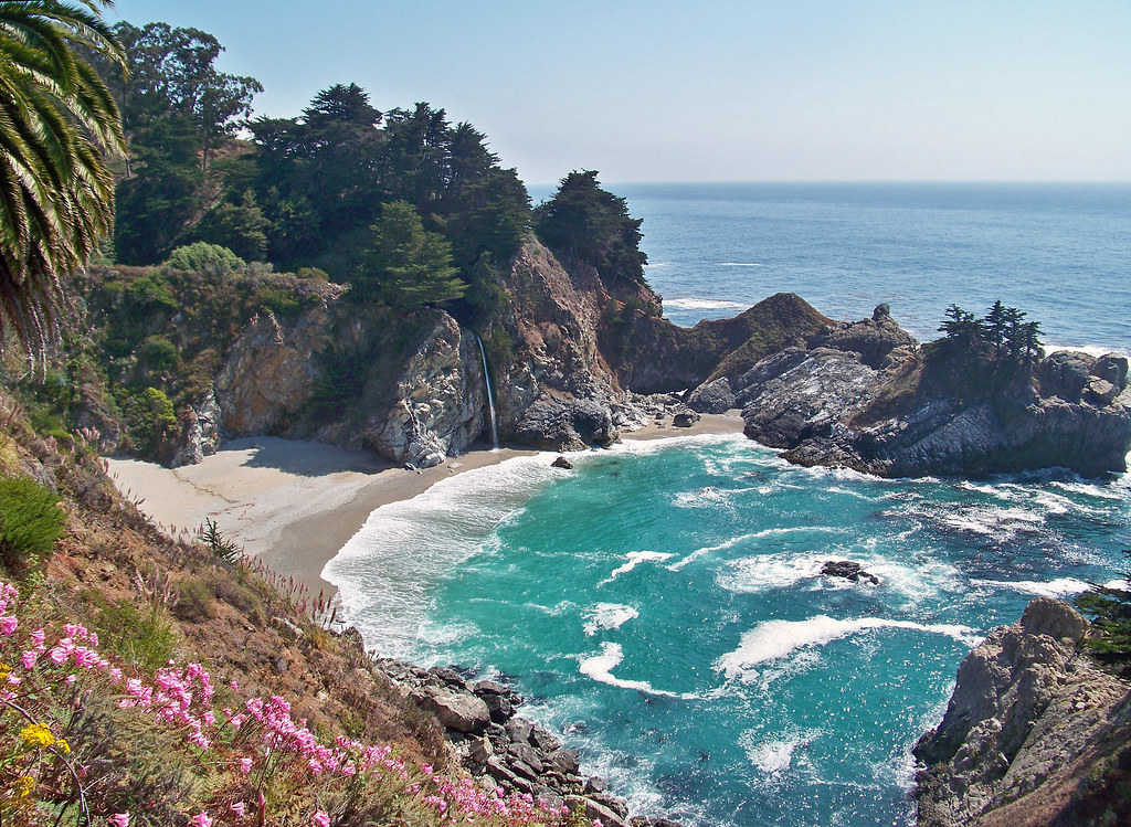
Past Bixby, you’re in the heart of Big Sur. A quick, honest note here: the short overlook trail to McWay Falls, inside Julia Pfeiffer Burns State Park, is currently closed — California State Parks’ own alert for the park states plainly that the beach, Saddle Rock, and the McWay Falls overlook area are off-limits while fire-suppression and repair work continues in the area, with no beach or ocean access permitted. Don’t plan your day around getting that classic waterfall-onto-the-beach photo right now; check the official Julia Pfeiffer Burns State Park page before you go, since these restrictions do get lifted as repair work finishes.
What is open and worth the detour: Pfeiffer Beach, reached via unmarked Sycamore Canyon Road (look for a small yellow “narrow road” sign — there’s no other marker) off Highway 1. It’s the one with the purple-tinted sand, a mineral called manganese garnet washing down from the cliffs above, and it’s most visible after a fresh batch of surf. The access road is narrow and the parking lot fills up, so plan to be flexible on timing. It’s day-use only, gates close at sunset, and there’s a $10 per-car fee.

Keep heading south through the rest of Big Sur — it’s slow going by design, and that’s fine, since the views are the whole reason you’re here — until you reach San Simeon, about two hours further down the coast. This is Hearst Castle territory: newspaper magnate William Randolph Hearst’s 1920s hilltop estate, now a California state historical monument, with Mediterranean Revival towers visible from the highway below.

You can’t just show up and wander in — access is by guided tour only, departing from the visitor center at the base of the hill, and the property is popular enough that booking your tour online in advance is worth doing rather than hoping for same-day availability. The standard Grand Rooms tour is the one most first-time visitors should book — it covers the main house’s most photographed spaces and runs a little under two hours door to door.
A few minutes further south, keep an eye out for the Piedras Blancas Elephant Seal Rookery — a free roadside viewing area where you can watch wild northern elephant seals hauled out on the beach, sometimes by the hundreds, without any ticket or reservation required. Timing matters a lot here (the seals’ numbers and behavior shift dramatically by season), so it’s worth reading a dedicated guide before you go rather than just hoping you catch a good day — California Wanderer’s own elephant seal viewing guide breaks down exactly when to time it.
End the day in Cambria, a small Central Coast town about 10 minutes past San Simeon that makes a good, quiet base for the night — it’s a lot less expensive than Carmel and puts you close to both Hearst Castle and tomorrow’s drive south. For where to actually stay and what to do with an evening there, California Wanderer’s Cambria town guide covers it in more detail than fits here.
Day 3: Cambria to Santa Barbara via the Central Coast
The coastline eases up considerably south of Cambria — this is a day of easier driving and small-town stops rather than dramatic cliffside switchbacks.
About 20 minutes south, Morro Bay is built around Morro Rock, a 576-foot volcanic plug rising straight out of the harbor that’s visible from miles away. It’s one of the most immediately recognizable landmarks on this whole route, and it’s an easy five-minute stop right off the highway.

From there it’s a short hop to San Luis Obispo — worth a stop for lunch and a walk around its compact, walkable downtown — and then on to the beach towns of Avila Beach and Pismo Beach, which sit close enough together that most people end up debating which one to actually stop at. California Wanderer’s Avila vs. Pismo comparison is worth a read if you’ve only got time for one.
The last major stop of the day is Santa Barbara, sometimes called the American Riviera, and it earns the nickname — Spanish colonial architecture, palm-lined State Street, and the Old Mission Santa Barbara, an active Franciscan mission founded in 1786 whose current facade dates to a 1927 rebuild after an earthquake. It’s free to walk the grounds and a small fee to enter the museum and cemetery.

Santa Barbara has enough going on to justify staying the night here rather than pushing straight through to LA — California Wanderer’s full Santa Barbara guide covers where to eat, what to do, and where to stay if you want more than a highway-side glance at it.
Day 4: Santa Barbara to Los Angeles
The final leg is the shortest — about 95 miles — and the most different in character from everything before it. Highway 1 merges with US 101 for a stretch, then splits off again as you approach Malibu, where the Santa Monica Mountains crowd right up against the Pacific and the highway is lined with a mix of public beaches and famously private ones.

Stop at Malibu Pier or one of the public beach access points if you want one last coastal break before the drive turns into city driving. From Malibu it’s a straight shot into Los Angeles — the ocean views end, the traffic picks up, and the trip is basically over once you hit the 10 freeway.

What to Pack for a Pacific Coast Highway Road Trip
You don’t need much beyond the basics, but a few things genuinely make a multi-day coastal drive easier:
- A phone mount for the dashboard — cell service and GPS both cut out for stretches through Big Sur, so having your phone visible and charging (rather than sliding around the passenger seat) matters more here than on a normal road trip.
- Polarized sunglasses — the glare off the ocean on a clear afternoon is intense enough to be genuinely distracting while driving west-facing stretches of the highway.
- A packable layer — Big Sur’s coastal fog can knock 15–20 degrees off the temperature in minutes, even in summer, so a jacket that packs down small is worth the glove-box space.
Practical Tips for Driving the PCH

A handful of things that’ll save you a headache:
Check road conditions before you leave, every single time. Highway 1 through Big Sur is genuinely prone to closures from landslides, storm damage, and wildfire-related restrictions — conditions that can change with little notice. The Caltrans road conditions page for Highway 1 is the most current source, and it’s worth a five-minute check the morning you actually drive through.
Gas up whenever you’re below half a tank through the Big Sur stretch specifically — there are exactly a couple of stations between Carmel and San Simeon, and they know they’re the only option.
Don’t plan on relying on cell service for most of the Big Sur stretch. Download offline maps before you leave Carmel, and let anyone expecting to hear from you know you’ll likely be quiet for a few hours.
If you get stuck behind slower traffic (RVs, in particular, are a fact of life on this road), there are marked turnouts specifically for pulling over and letting people pass — use them rather than trying to pass on a blind curve, which is exactly how this road’s worst accidents happen.
Frequently Asked Questions
How many days do you need to drive the PCH from San Francisco to LA?
Four days is realistic if you want to actually stop at things. You can technically drive it in one very long day, but you’ll be rushing through the best parts of Big Sur, and a lot of that road isn’t safe to drive quickly regardless.
Is Highway 1 through Big Sur currently open?
As of this writing, yes — Highway 1 is open the full stretch from Carmel to Cambria, aside from routine construction-related delays. That said, this is one of the most closure-prone stretches of highway in California, so always check the Caltrans conditions page before you drive it, not just before you book the trip.
Can you see McWay Falls right now?
Not from the usual overlook trail — it’s currently closed, with the beach and falls area off-limits, while fire-suppression and repair work continues in Julia Pfeiffer Burns State Park. Check the park’s official page for the latest before you build a stop around it.
Do you need reservations for Hearst Castle?
Not strictly — same-day tickets are sometimes available at the visitor center — but tours do sell out, especially on weekends, so booking online in advance is the safer move if this is a must-see for you.
Leave a Reply