
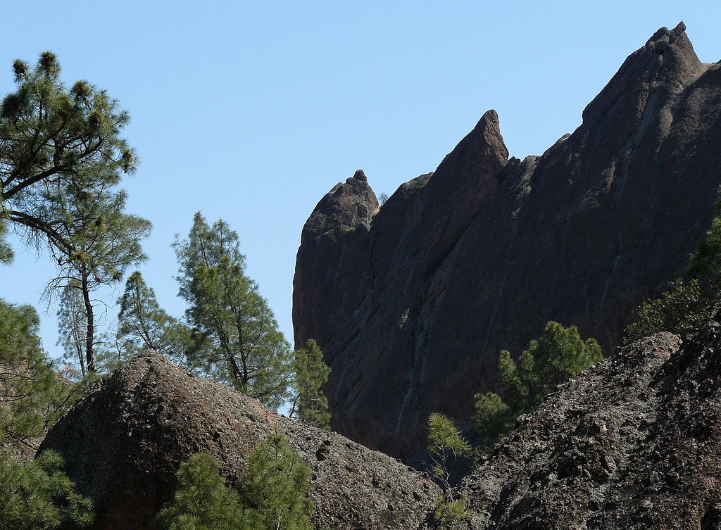
Pinnacles National Park has a problem most national parks don’t: two separate entrances that don’t connect to each other by road. Pick the wrong one for your plans and you’re not just annoyed — you’re looking at a highway drive of roughly an hour and a half around the park to get to the side you actually needed.
So before you type “Pinnacles National Park” into your GPS and hope for the best (it can route you to either side, which is exactly how people end up at the wrong one), here’s what each entrance actually gets you, and where to stay if you’re making a night of it. Pinnacles itself has almost no lodging to speak of, so that part matters more here than it does for most parks.
This article may contain affiliate links. If you book or buy through one, California Wanderer may earn a small commission at no extra cost to you. As an Amazon Associate I earn from qualifying purchases.

Why You Can’t Just Pick One on a Whim
No road inside Pinnacles connects the East Entrance to the West Entrance. None. If you park at one and decide halfway through the day that you’d rather be at the other, your only way there is on foot across the park’s interior (a serious hike, not a shortcut) or back out to the highway and around through King City — about 90 minutes of driving in normal traffic.
That’s the whole reason this decision is worth five minutes of planning instead of a coin flip. The two sides have different caves, different trails, different hours, and only one of them has a campground.
The East Entrance (near Hollister)
Reach it from the Bay Area on Highway 101 South to Gilroy, then Highway 25 South through Hollister, then Highway 146 West into the park. Coming from the south on 101, exit at King City and work your way over to Highway 25 North instead — the official NPS directions route you onto Bitterwater Road to connect the two.

This is the side with Bear Gulch Reservoir and Bear Gulch Cave, and it’s the only side with a campground — if you’re sleeping inside the park, this is your entrance, full stop. Trail access here is open 24 hours a day, though overnight parking outside the campground itself isn’t allowed. The East Pinnacles Park Store runs 9am to 4pm with a lunch closure from noon to 1pm, and the Bear Gulch Nature Center keeps irregular hours depending on staffing — don’t plan your whole day around it being open.
If you’re short on time or hiking with kids, the Moses Spring to Rim Trail Loop (2.2 miles) is the easiest way to see what makes this park worth visiting without committing to a full day. Parking is the real logistics problem on this side: get to the Moses Spring lot early, because it’s the closest option to the good trailheads and fills first. Once that’s gone, Bear Gulch Day Use is next (it has restrooms and picnic tables), and after that you’re looking at Peaks View, Manzanita, or Old Pinnacles — all of which mean a 1 to 2.5-mile walk just to reach Bear Gulch.
The West Entrance (near Soledad)
This side is reached off Highway 101 at Soledad, then 14 miles east on Highway 146. One thing worth knowing before you commit to this route: Highway 146 narrows to a single lane as it approaches the park. Drive it carefully, and don’t attempt it in an RV or towing a trailer — it’s genuinely not built for either.
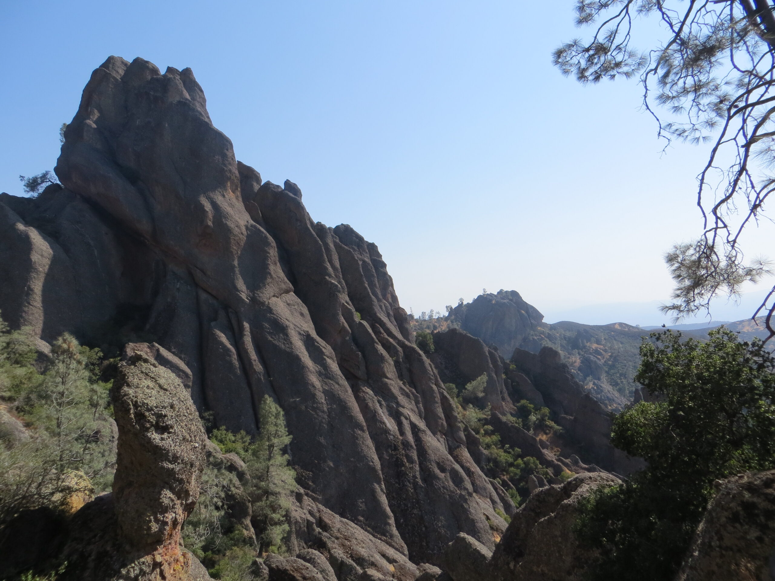
The West Entrance gate is open 7:30am to 8pm, and it’s day-use only — no overnight parking, no camping anywhere on this side. The West Pinnacles Visitor Contact Station runs 9am to 3pm. What you get here is Balconies Cave, plus some of the park’s better up-close views of the rock formations the park is actually named for, right from the parking area.

Trail-wise, the West side splits into easy and genuinely hard. The Balconies Cliffs and Caves Loop (2.4 miles) is the approachable option and the one most visitors should plan around. The Juniper Canyon Loop (4.3 miles) is the way up into the High Peaks from this side, and it’s steep — don’t start it late in the day or underestimate it because the mileage looks modest.

The Caves: One Thing You Genuinely Cannot Skip
Whichever entrance you use, if a cave is on your list, bring a real flashlight. This isn’t a nice-to-have — the park’s own safety guidance calls it essential for Balconies Cave and mandatory for Bear Gulch Cave. Both caves are talus caves (gaps between massive jumbled boulders, not carved rock), which means dark passages, low ceilings, narrow squeezes, and uneven footing the whole way. Sturdy shoes with real tread matter here too; this isn’t a sneakers-and-sandals trail.

What to Pack for the Pinnacles Caves
- a reliable flashlight or headlamp — the park’s own safety page calls a flashlight mandatory for Bear Gulch Cave and essential for Balconies Cave. A headlamp does the same job and leaves both hands free for the uneven, boulder-strewn footing inside.
Here’s the part that trips people up: Bear Gulch Cave is seasonal, and Balconies usually isn’t. Bear Gulch closes entirely from mid-May through mid-July to protect a maternity colony of bats, and its Upper Cave rarely opens at all outside of that. March and October tend to be the most reliable months to get the whole thing open. Balconies Cave doesn’t follow that same pattern, but either cave can close without notice for flooding, rockfall, or other safety issues — check the park’s current cave status page before you drive out, not after. For more on what’s currently open and the park’s condor activity, our Pinnacles condor viewing and cave status guide covers that in more depth.
Fees, Parking, and Crowds
Entry runs $30 per vehicle (covers up to 15 people, valid 1 to 7 days), $25 per motorcycle, or $15 per person if you’re arriving on foot or by bike. Both entrance stations take cards only — no cash — so don’t plan on paying with bills you grabbed on the way out the door. If you’re coming back within the year, the $55 Pinnacles annual pass pays for itself after two visits; the America the Beautiful pass works here too. Full current pricing and pass details are on the park’s own fees and passes page.

Parking is genuinely tight on both sides, and it’s the single biggest thing that can wreck your day if you don’t plan for it. Local reporting has put total capacity at roughly 267 spaces across six lots on the East side and around 142 spaces across three lots on the West — treat those as rough, not official, but the gap between the two sides is real and worth knowing before you pick an entrance expecting the same experience on either side. On weekends, holidays, and pretty much any nice spring day, expect real delays getting in between 10am and 3pm. Get there before 8 or 9am if you want an actual parking spot at a real trailhead instead of a long walk-in from the overflow lots.
One more thing worth doing before you leave home: if you’re using a digital pass, save or print it ahead of time. Cell service inside Pinnacles is limited to nonexistent, so pulling up a pass on your phone at the gate isn’t something you can count on. The East side’s shuttle (useful for easing the Bear Gulch parking crunch in peak season) also doesn’t run year-round — it’s seasonal, so don’t bank on it being available outside of spring and summer.
Both sides have the same basic hazards worth taking seriously regardless of which entrance you pick: stinging nettle grows near the Balconies Cave entrance and along the trail below Bear Gulch Cave, and poison oak shows up along most trails in the park. Carry more water than you think you’ll need — there’s no drinking water available on the trails themselves, only in the developed areas near each entrance.
And if you’re the type who comes back more than once, buy the Pinnacles annual pass at either entrance station rather than the America the Beautiful pass — at $55 against $80 for the federal pass, it’s the better deal if Pinnacles is the only park you’re actually planning to revisit this year.
Where to Stay Near Pinnacles

Set expectations here: Pinnacles isn’t a park with a lodge or a cluster of hotels at the gate. The only lodging inside the park is the campground on the East side, booked through Recreation.gov like any other national park campground — there’s no lodging of any kind on the West side, where overnight parking isn’t even allowed.
If you want a roof over your head, you’re staying in a gateway town and driving in. Hollister, about 30 miles from the East Entrance on Highway 25, is the nearest real town on that side, with a handful of budget-tier chain and independent motels — a SureStay by Best Western and the smaller Cinderella Motel among them. It’s not a resort town; it’s a practical place to sleep before an early start. Soledad, sitting right on Highway 101 near the West Entrance, has a similarly modest lineup, including a Motel 6 directly in town. Either way, set your expectations at “convenient and basic,” not “destination in its own right” — the honest selling point is proximity to an early trailhead, not the town itself.
If neither gateway town appeals and you’re coming from the south, King City (also on 101, closer to the East side’s southern approach) is worth a look too. Whichever you pick, book ahead for a spring weekend — rooms in all three towns are limited, and Pinnacles’ own spring wildflower season pulls a lot of day-trip traffic through the area.
So, Which Entrance Should You Actually Use?
If you’re coming from San Francisco, the Bay Area, or Sacramento, want the reservoir, or you’re camping, the East Entrance is the obvious pick — it’s the more direct route from the north and the only side with anywhere to pitch a tent. If you’re coming up from the Central Coast, Los Angeles, or anywhere south, or Balconies Cave is the priority, head for the West Entrance instead.
Doing an overnight trip? Spend one day on each side rather than trying to cross between them — it covers both caves and skips the 90-minute connector drive entirely. On a single day, commit to one entrance and build your whole visit around it. Trying to see both sides in one day isn’t a parking problem or a hiking problem, it’s a driving problem, and it’s not worth the hours it costs.
Leave a Reply