
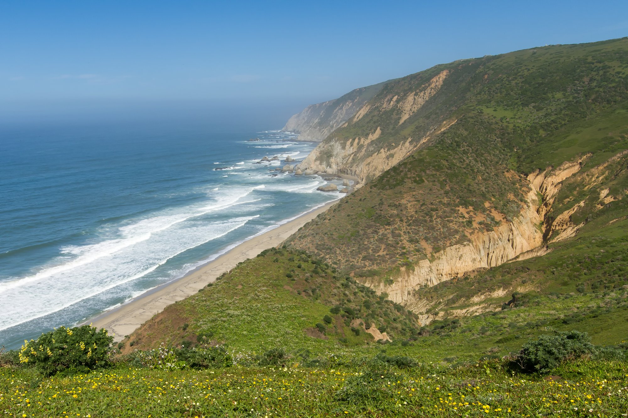
San Francisco sits within day-trip range of two of the most photographed stretches of coastline in the country, and they could not be more different from each other. Point Reyes gives you wind-scoured headlands, tule elk, and a lighthouse that spends half its life wrapped in fog, all about an hour from the Golden Gate Bridge. Big Sur gives you the postcard version of Highway 1 — McWay Falls, Bixby Bridge, purple sand — but it costs you most of a day just getting there and back. If you’ve only got one Saturday, you need to know which one actually fits it.
This article may contain affiliate links. If you book or buy through one, California Wanderer may earn a small commission at no extra cost to you. As an Amazon Associate I earn from qualifying purchases.
Quick answer: if you have well under a full day, or you want a real shot at wildlife (elk, and elephant seals in winter), go to Point Reyes. If you have a full day to burn on driving and you want the single most cinematic coastline in California, go to Big Sur — just don’t pretend it’s a quick trip, because it isn’t.
At a Glance: Point Reyes vs. Big Sur
| Point Reyes | Big Sur | |
|---|---|---|
| Drive from San Francisco | About 40 miles / roughly an hour via Highway 101 and Sir Francis Drake Blvd | Around 140 miles to the village of Big Sur (about 2.75 hours); closer to 3–3.5 hours each way if you’re going as far as McWay Falls |
| Realistic round trip | Very doable as a half-day trip, easy as a full day | A genuinely full day, gone entirely to driving and stops — don’t book anything else for that Saturday |
| Best for | Wildlife, hiking, a shorter or more flexible outing | Dramatic coastal scenery, a proper road-trip feel |
| Reservation/timed entry | None — Point Reyes’s old winter shuttle system has been suspended since 2020, and its roads are simply open to private cars | None for the road itself, but Pfeiffer Beach charges a day-use fee and its lot is small |
| Weather wildcard | Fog, especially at the lighthouse and headlands, is the default, not the exception | Fog and sun can both happen the same day depending on how far south you get; Highway 1 itself is subject to closures after storms |
Point Reyes: What a Day Trip Actually Looks Like
From San Francisco, the fastest way in is north on 101 across the Golden Gate Bridge, then off onto Sir Francis Drake Boulevard about nine miles past the bridge. That road winds west for roughly 21 miles through Marin’s small towns before it connects to Highway 1 at Olema, right at the edge of Point Reyes National Seashore. Call it about 40 miles and an hour, traffic depending — genuinely one of the easiest “big nature” day trips within reach of the city.

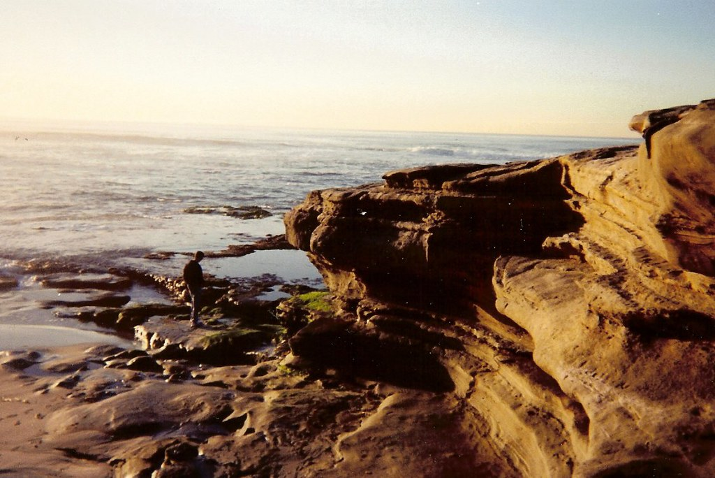
Once you’re in the park, the Point Reyes Lighthouse is the obvious anchor for a first visit — a steep set of stairs down to a working 1870s lighthouse perched on the edge of the peninsula. Go in expecting fog. It rolls through often enough that “foggy” should be your baseline assumption, not your bad luck; if you get a clear day, treat it as a bonus, not the plan. From the lighthouse area and the nearby Chimney Rock trail, December through May is prime whale-watching season, when gray whales pass close enough to the point to spot from land with a decent pair of binoculars.
If you’d rather hike than stand at an overlook, the Tomales Point Trail is the better call — it runs along the northern finger of the park through open grassland where a free-ranging tule elk herd actually lives, not a zoo enclosure, a real herd on real headlands. Elephant seals are the other big wildlife draw, but be honest with yourself about timing: the colony hauls out in real numbers from December through March for pupping and mating season, and a September or summer visit will mean a much thinner showing, if any. Don’t build a whole trip around seeing them outside that window — if your visit falls outside it, San Simeon’s much larger colony farther down the coast is viewable across more of the year.
Point Reyes Station, the little town just outside the park boundary, is the easy lunch stop — a real Main Street with a bakery and a few good local spots, not a strip of chain restaurants. Between the drive, the lighthouse, a hike, and lunch, you can do Point Reyes properly in half a day and still be home for dinner, or stretch it into a full, unhurried day if you want to actually sit with the scenery instead of checking boxes.
Big Sur: What a Day Trip Actually Looks Like
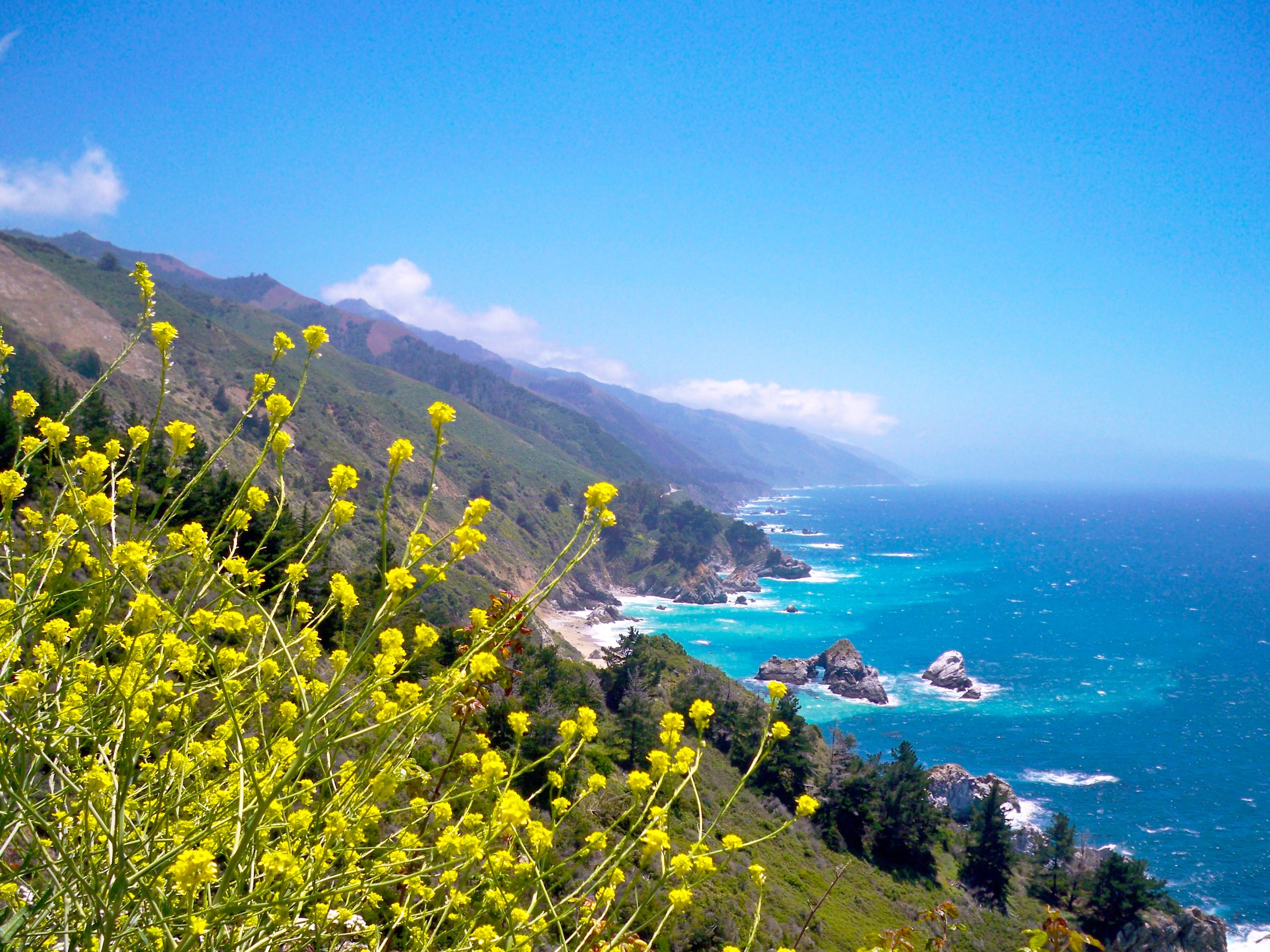
Big Sur is a different commitment before you’ve even parked anywhere. It’s around 140 miles from San Francisco to the village of Big Sur itself — call it 2 hours 45 minutes with no stops — and if your real destination is McWay Falls or Pfeiffer Beach further south, plan on closer to 3 to 3.5 hours each way once you factor in Highway 1’s slower, winding pace through Monterey and Carmel. That’s 6 or 7 hours of driving alone, round trip, before you’ve stopped for a single photo.

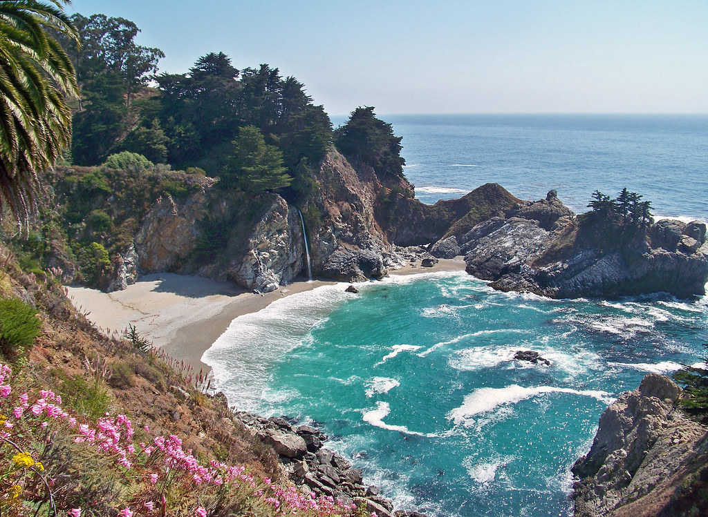
The reason people still do it: nowhere else on this coast looks quite like it. McWay Falls, inside Julia Pfeiffer Burns State Park, is the single most photographed stop — an 80-foot waterfall that drops straight onto a sandy cove you’re not allowed to walk down to, so you view it from a short bluff-top trail instead. Bixby Bridge, the graceful concrete arch a bit further north, is the other unmissable stop; there’s a small pullout on either side where everyone gets out to take the same photo, and it’s worth it anyway.
For something less on every postcard, Pfeiffer Beach is worth the detour if you have the time — its sand actually runs purple and pink in streaks where manganese garnet washes down from the hillside, most visible when the sand is wet. The turnoff has no highway sign (watch for a “narrow road” marker near mile 45.64 and a sharp turn), the access road is one lane in places, and there’s a $12 day-use fee for the roughly 50 parking spots — it fills up on weekends, so this is a stop to build in time for, not squeeze in on the way past.

One more thing worth doing before you commit to the drive: Highway 1 through Big Sur has a real history of storm damage and slide-related closures, including a multi-year closure that only fully reopened in early 2026. As of late September 2026 the road is open with no restrictions, but check Caltrans QuickMap the morning you leave — a five-minute check beats finding out about a closure 100 miles from home.
Which One Should You Actually Pick
If you’re short on time, have kids or anyone who gets carsick on winding roads, or you specifically want a shot at wildlife, Point Reyes wins — it’s closer, it’s flexible, and you can genuinely do it as a half-day trip without feeling rushed. If you have a full day free, you’re comfortable with several hours of curvy coastal driving, and what you actually want is the iconic, screensaver-worthy version of the California coast, Big Sur is worth the commitment. It’s not a close call on convenience; it’s a real trade of distance for drama.
Weather is the other tiebreaker. Point Reyes runs foggy more often than not, which some people find moody and beautiful and others find genuinely disappointing if they were hoping for a clear ocean view. Big Sur’s weather is more of a toss-up depending how far south the fog bank sits that day, but its landscape — cliffs, bridges, redwood-lined canyons — tends to read as dramatic in almost any light, fog included.


Can You Do Both in One Day?
Not realistically, no. Point Reyes is north of San Francisco and Big Sur is well south of it; combining them means backtracking through the city and adding hours of driving on top of two already-long legs. If you’re determined to see both on one trip, do them on separate days — Point Reyes as an easy half-day, Big Sur as its own dedicated full day, ideally with an overnight in Big Sur or nearby Carmel if your schedule allows it, since it takes the pressure off getting back before dark.
Prefer a Guided Trip Instead of Driving Yourself?
If the idea of white-knuckling Highway 1’s curves yourself doesn’t appeal, or you’d rather not deal with parking at Point Reyes on a busy weekend, a guided day tour handles the driving and usually hits the highlight stops in less time than you’d manage solo, since the driver already knows exactly where to pull over.
What to Pack for Either Trip
What to Pack for a Point Reyes or Big Sur Day Trip
- a packable windproof rain layer — both coasts run windy and cool right at the water even on a warm inland day, and fog at Point Reyes can turn a t-shirt afternoon into a genuinely cold one.
- a compact pair of binoculars — worth having in the car for elk, elephant seals, or a gray whale spout well offshore — naked-eye wildlife spotting from these overlooks is hit or miss.
- a pair of real trail shoes — several of the best viewpoints on both coasts (Chimney Rock, the McWay Falls overlook, Pfeiffer Beach’s soft sand) are reached by uneven trail or loose sand, not pavement.
If you decide Big Sur deserves more than a rushed day trip — a lot of first-timers end up feeling that way once they’re actually on that road — it’s a legitimately good overnight destination, and looking at lodging options along the coast ahead of time is worth doing before you go, since availability is limited and books up early for weekends.
Frequently Asked Questions
Is Point Reyes or Big Sur better for families with young kids?
Point Reyes, generally — it’s a shorter drive, the elk-viewing trail is manageable, and there’s less time strapped in a car seat on switchbacks. Big Sur’s viewpoints are beautiful but often involve cliffside pullouts and short trails with real drop-offs, which take more supervision with small kids.
Do I need a reservation or permit for either destination?
No. Neither Point Reyes nor the Big Sur coastline requires a park reservation or timed-entry permit as of this writing. The one fee to plan for is Pfeiffer Beach’s $12 day-use charge for parking.
When is the best time of year to see elephant seals or whales near Point Reyes?
Elephant seals haul out in the biggest numbers from December through March. Gray whales pass by on their migration from roughly December through May. Outside those windows, don’t count on seeing either — go for the hiking and the headlands instead, and treat any wildlife sighting as a bonus.
Is Highway 1 through Big Sur currently open?
It is, as of late September 2026, following an early reopening after a multi-year storm-damage closure. Conditions can still change quickly after winter storms, so check Caltrans’ current road conditions before you drive down, especially outside of summer.
Planning more time around San Francisco itself? Our full roundup of San Francisco day trips covers other car-reachable options if neither of these two quite fits your day.

Leave a Reply